Non-motorized Trail Dashboard
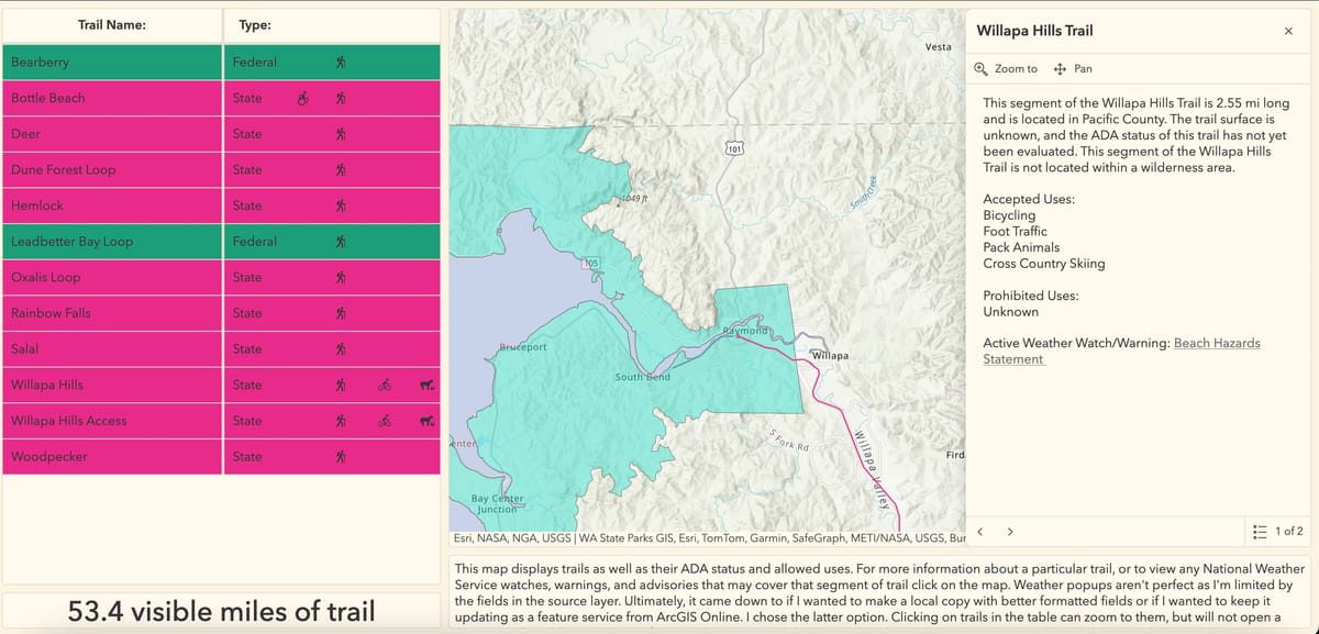
This dashboard is the product of a weekend arcade workshop, with a particular focus on arcade's ability to format live-updating data feeds with minimal intervention. The dashboard is capable of identifying if a selected trail segment intersects a feature from the live watches and warnings feature layer produced by the National Weather Service. If this is the case, it displays some data (including a link to the original weather statement or bulletin) within the trails popup. Additionally, the list to the left of the map shows allowed trail uses and ADA status. List items are made up of grouped segments and only show a trail as accessible it is true across the entire trail. This is also true for allowed uses, while pop-ups contain more specific ADA and use information for each segment. Unfortunately, I had to create and upload a local version of the trails in order to display all jurisdictions in a single table rather than using the original feature layers. However, the table and pop-ups will include any additional trails uploaded later, as they are automatically formatted in arcade rather than being formatted manually.