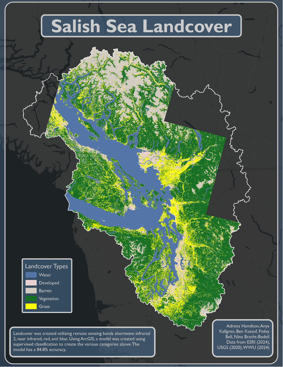
NDVI and Landcover Classification
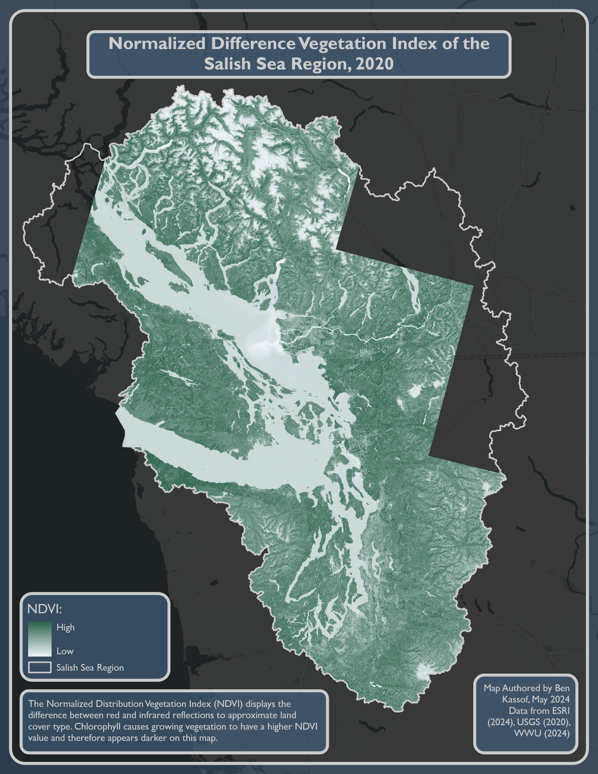
This map is from a landcover classification unit in the Advanced GIS Applications class I took during the spring of 2024. This involved downloading Landsat imagery and using ArcGIS Pro to create Normalized Difference Vegetation Index (NDVI) and Normalize Difference Building Index (NDBI) maps as well as using the image classify tool. This involved making a raster mosaic, creating training samples, and using a confusion matrix in RStudio to assess the accuracy of our classification.
I also used this project as an opportunity to experiment with cartography, departing from my usual lighter color palette in favor of a darker basemap. Rather than using a solid color outside my map frame, I instead opted for a second map frame to convey that the map continues beyond the borders of this particular layout. This map frame is stretched over the entire layout, with a semi-transparent blue rectangle overlaid on top of it. I then added a second map frame over that rectangle with a silver border to make the border between the two maps a little bit more distinct. The center and extent of the two map frames are linked, meaning that it functions as a single map frame while still including the blue overlay around the edges of the map. I also continued the silver and semi-transparent blue colors into the other layout elements, outlining the Salish Sea as well as my legend and text boxes.