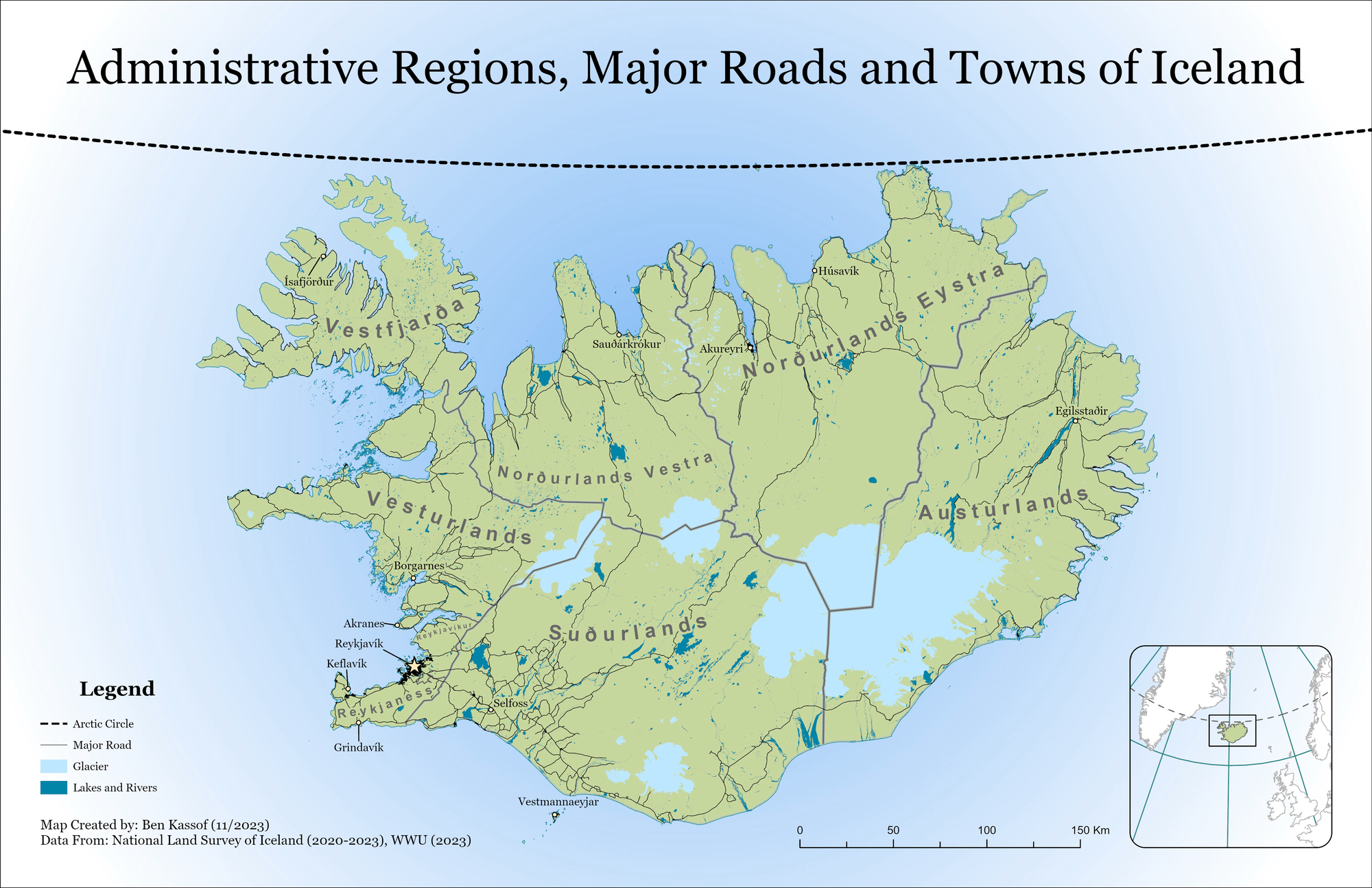
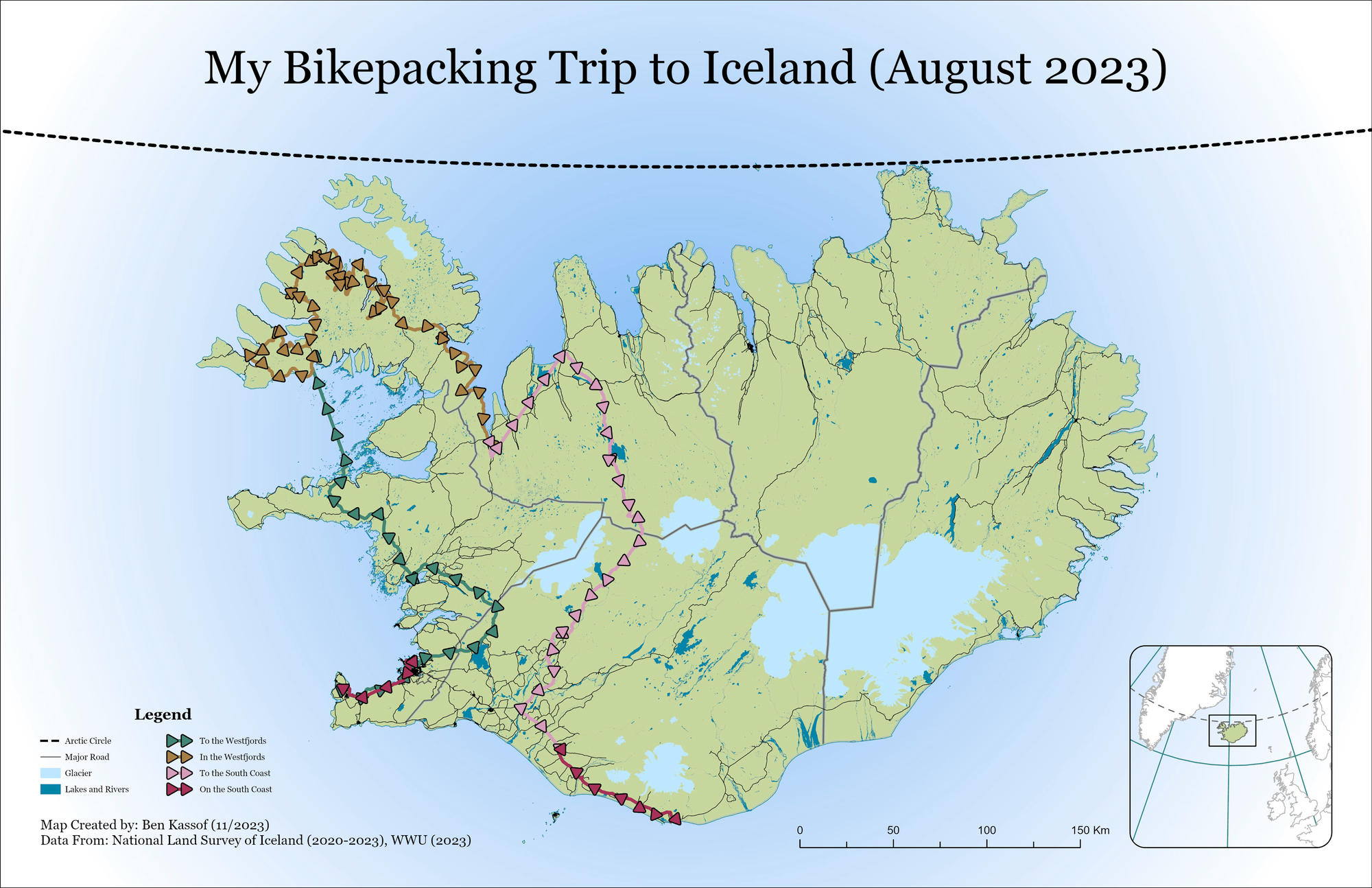
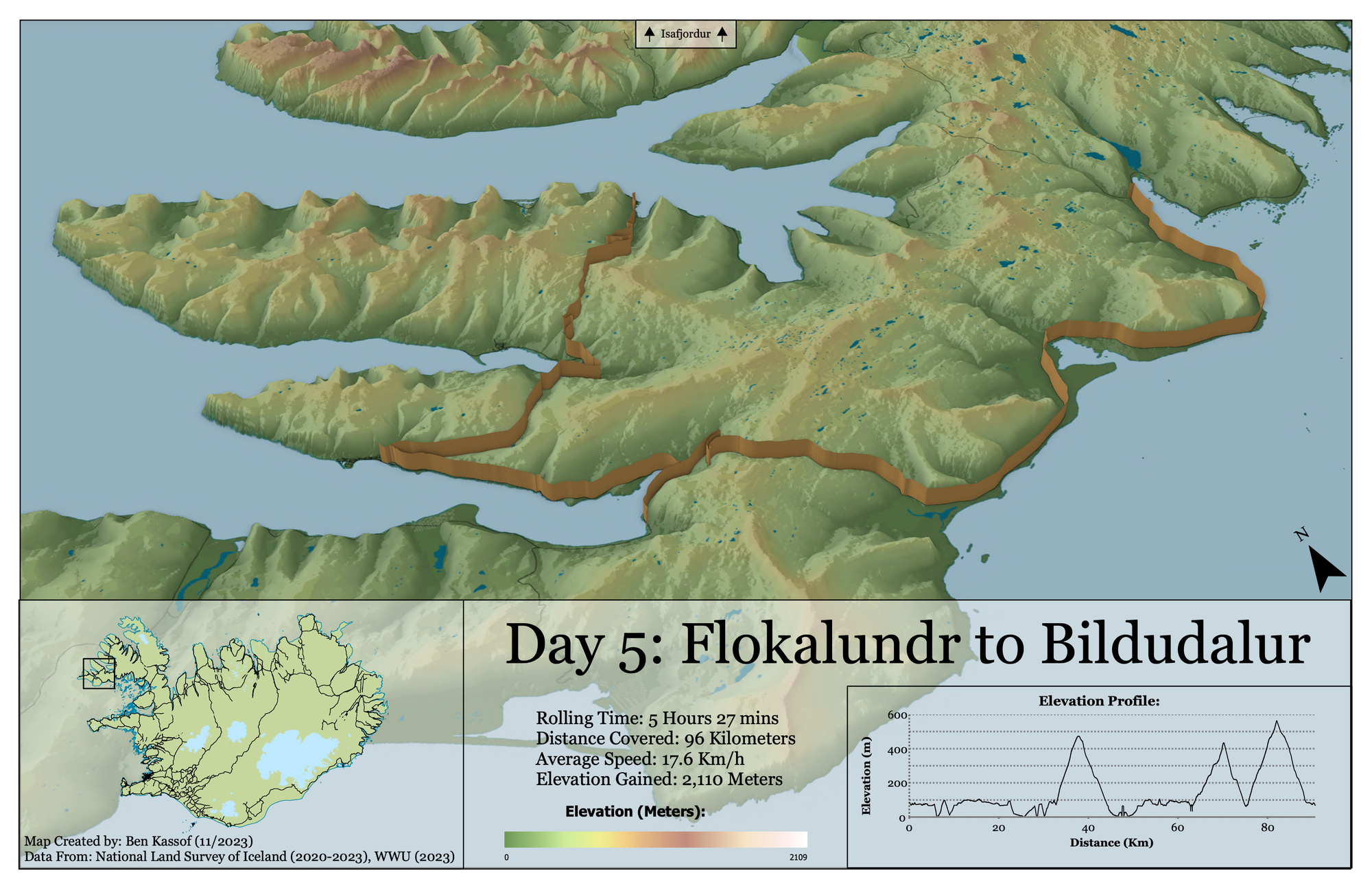
Iceland Series
This is a series of three maps as well as a storymap, all of which were created for a cartography class. Together, they document a bikepacking trip that I went on during the summer of 2023. For this series I wanted to experiment with a more stripped-back and borderless style, as well as gaining experience with some of the 3D tools available in ArcGIS Pro. Iceland being an island complemented this approach, as I could simply fade out the ocean without having to deal with any other bodies of land. The 3D perspective of the third map was chosen to emphasize the elevation changes present in the Westfjords region. Although elevation was exaggerated in order to make it more noticeable in map form, I did still gain 2,110 meters (nearly 7,000 feet) of elevation over just 96 kilometers (roughly 60 miles).