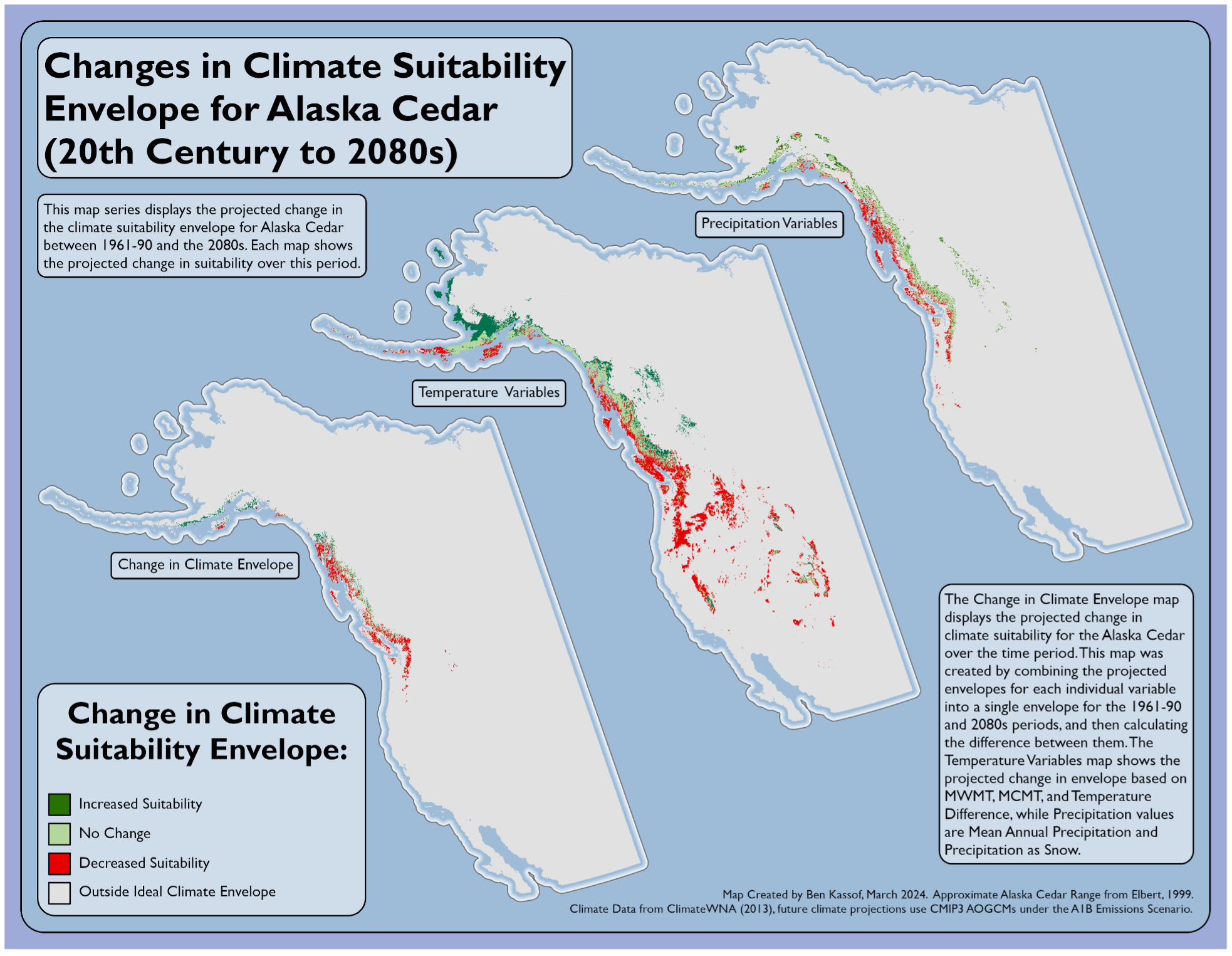
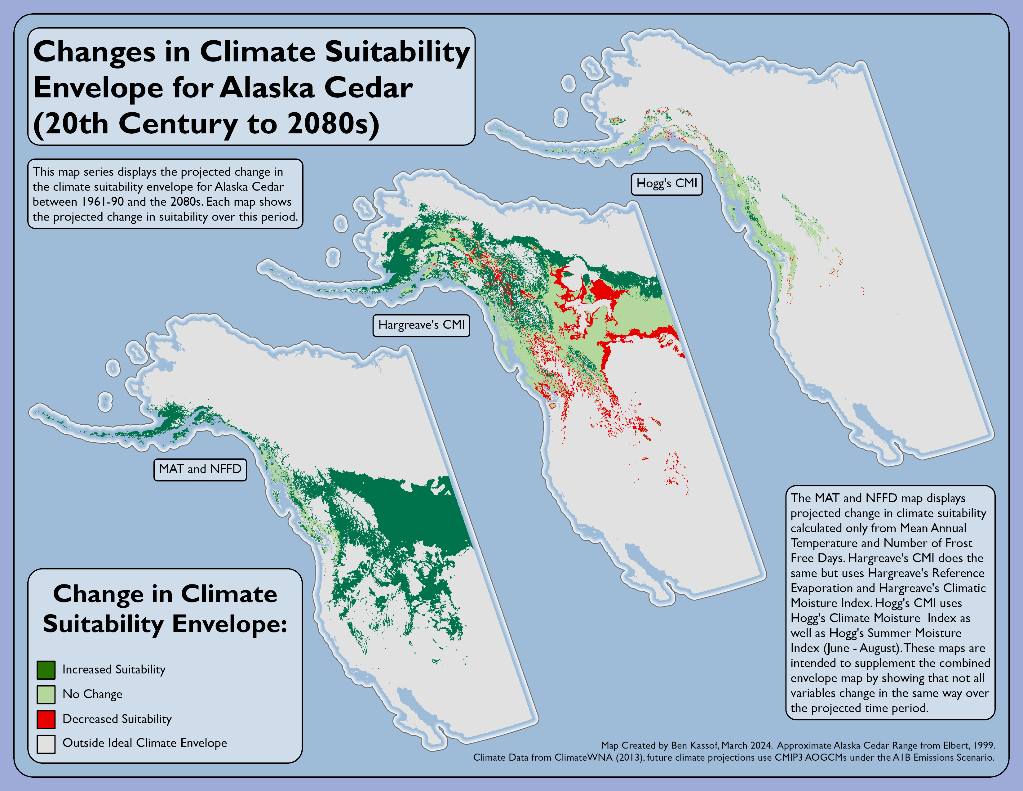
Climate Suitability Envelope Modelling
These two maps were part of a larger group project modelling the climate suitability envelope for the Alaska Yellow Cedar. We began with a shapefile of the tree's estimated range as well as rasters containing numerous climate variables from 1961-1990. After constructing a climate envelope using these temperature variables, we then modeled the predicted future range using a 2080s climate model from the 2013 A1B emissions scenario. Finally, we subtracted the predicted range from the current one, producing the two maps seen below. These maps display change in categories of climate variable, as well as the predicted change in overall climate suitability. In hindsight, we may have been a little overzealous in selecting variables and I believe that a more selective analysis would likely produce a less dire prediction.